
Dreamt by Oliver Cleveland & Ella Tarwid
The northernmost parking lot of Mayo Clinic sits on the corner of 10th and Division Streets, and has around two hundred and twenty-two spots. The other Mayo parking lots are of similar size, some even bigger. Despite all this land space, the area isn’t particularly pedestrian friendly; it’s incredibly flooded and crammed with cars. Not only is it dangerous for pedestrians, but cars themselves have difficulty navigating the narrow roads. As for surroundings, it’s nearly a concrete jungle. The roads intersecting the hospital campus leave no room for greenery or any decoration. On the eastern border, it is bracketed by West Avenue, which is always busy and drowns the area in traffic noise. On the northern border, there are privately-owned houses, and on the southern border are Walgreens and, further, Jackson Street.
Finally, on the western border just across the street, there are buildings under construction: two multi-unit apartment complexes, one with 24 units and the other with 12 units, and then Viterbo University. These confines limit Mayo’s space, forcing them to utilize what they have practically rather than environmentally or aesthetically, which contributes to the cramped feeling of the campus. The construction for Mayo itself and the apartments only restricts it further. Most of the parking lots are for employees, which creates a problem: during the day, they are entirely full, but at night, entirely empty.
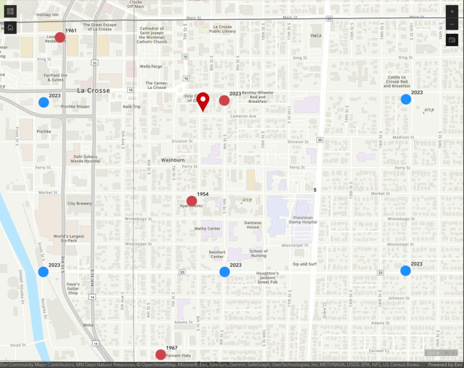
In the Forward La Crosse 2040 Comprehensive Plan, La Crosse is divided into districts to determine future land use. For the Mayo/Viterbo District, the City Council wants to emphasize the importance of public transit and affordable housing.1 The plan also highlights what citizens want for La Crosse, and one of the biggest requests is to uplift underrepresented voices.2
We talked to Mackenzie Mindel, the representative of Mayo’s district, about her hopes for the future of the area, and about Indigenous representation. Many of the problems in La Crosse—white wealth accumulation, lower retention rate, lower school enrollment—stem from a lack of diverse and affordable housing. She stressed the importance of establishing these. When asked about diversity in La Crosse, she said she aims for inclusivity and that the council aims to diversify investors in the city. We asked about the possibility of giving land back to Indigenous inhabitants, and she responded that the city may have something in store.
The presence of effigy mounds and village sites3 in La Crosse provide undeniable evidence of Ho-Chunk and Dakota living here for over 10,000 years, continuing to today with me, Wooraxiga (Oliver Cleveland), standing here. The following text is the Dakota land cession in “Western Wisconsin,” summarized by the Wisconsin Cartographers Guild:
“In 1837, federal Indian agent Lawrence Taliaferro convinced U.S. officials that the Dakotas still use the area and helped to secure favorable treatment for the tribe in the land cession. Many Dakota moved to the Minnesota side of the Mississippi River, where Dakotas still live on the Prairie Island Reservation. The case of the Dakota was the only successful removal of a tribe from Wisconsin.”4
Despite this history, the city of La Crosse continues to rally behind their problematic figures like Nathan Myrick5 and the lumber barons (Hixons).
Here’s what the guild says about the Ho-Chunk treaty of 1837:
“A delegation went to Washington in 1837 to plead for the tribe’s remaining lands, but its members were not allowed to go home until they ceded them. They finally agreed because they feared for their families well-being and believed verbal assurances that they would have eight years to leave Wisconsin, though the treaty allowed eight months and the treaty-abiding faction of the Ho-Chunk were moved to neutral ground around Iowa’s Turkey River.”6
In summary, the land that La Crosse sits on today was, for thousands of years, a communal border village/lacrosse field of the Ho-Chunk and the Dakota until 1837, when the Dakota sold the land to the United States. Soon after, both tribes faced deadly removals.
Then, in 1871, the Franciscan Sisters of Perpetual Adoration built the St. Rose Convent on Market and 10th Street, on that same land. About ten years later, the group founded St. Francis Hospital.7 In 1923, the Skemp Clinic was created, and finally, in 1995, St. Francis and Skemp merged with Mayo Clinic as we know it today.8
In 1900, however, the parking lot was still a group of houses, housing mostly working class individuals–some renting and some owning, a few European immigrants, and later on, young female nurses.9 By 1992, most of these houses had been demolished and made into parking spaces. It wasn’t until 2010 that the last house was removed and until 2020 that the lot was completed.10
The new housing northwest of Mayo is entirely for profit. One of the two new buildings is composed of expensive townhouses with exclusive communal centers. The other contains cramped ORI studios. ORI studios are too small to even fit a bed; they have an innovative technique that raises the bed into the ceiling to make the 300 sq. ft. apartment actually livable.11 These apartments are meant to maximize people and profit and generate wealth for monopolizing corporations. They’re taking up space that could be used for strengthening community, like the Washburn Community Garden that these apartments are built on top of.12 Community spaces are integral for the public, and corporations like Mayo are ripping them away.
Historically, hospital leadership has tried to rehabilitate some of the communities affected by these practices. The Franciscan Sisters made a historic land transfer, selling land in northern Wisconsin back to the Indigenous communities they harmed. The Indigenous community purchased the land at the exact price the sisters had paid for it in 1966.13
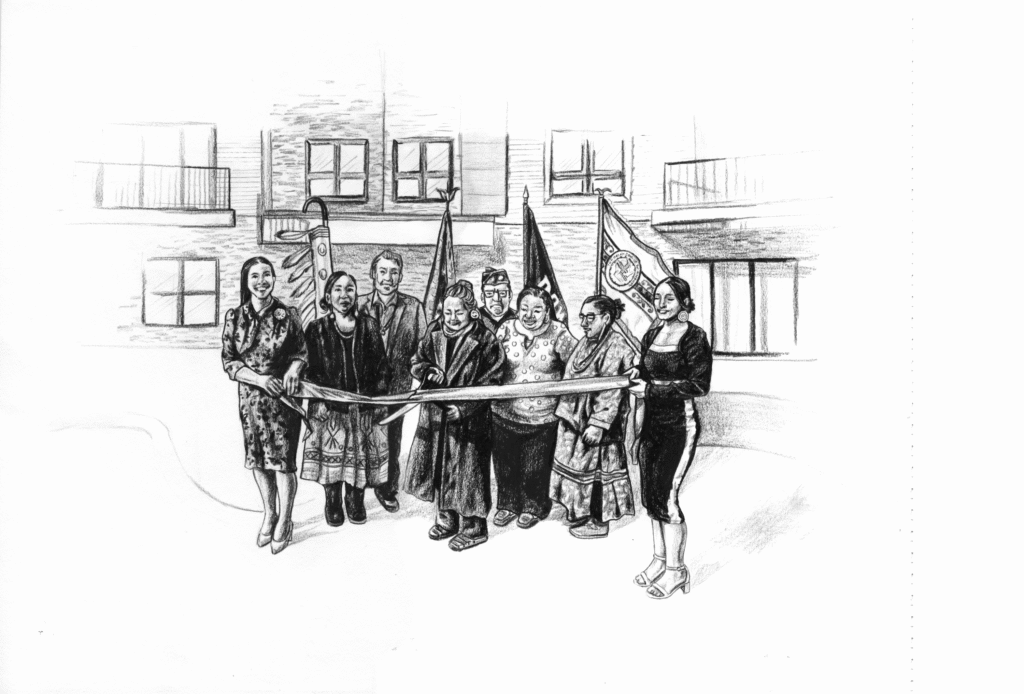
Unlike La Crosse County, counties such as Jackson, Monroe, Wood, Sauk, and Shawano all host large Ho-Chunk developments, including seven neighborhoods and multiple apartment complexes throughout the state.14 One of the Nation’s most innovative new developments, Cloud Village in Baraboo, was just recently completed.15 This 65,000-square-foot development delivers 40 apartment units in a mix of two- and three-bedroom layouts, featuring both underground and surface parking, basketball courts, and community amenities. Designed by Dimension IV Madison Design Group, Cloud Village incorporates sustainable features such as high-efficiency appliances, electric vehicle charging stations, and advanced storm water management. The project was completed ahead of schedule and under budget, thanks to the collaboration of Greenfire Management Services, the City of Baraboo, Colin Price,16 and the Ho-Chunk Nation.
When local governments work with Tribes, they achieve mutual prosperity, bridging the gap with benefits like the following:
Infrastructure Grants17: In Crawford County, for example, tribal partnership helped fund a critical bridge replacement. By designating the route as a “reservation access road,” the county secured $440,000 in federal funds for the project, in 2014. Crawford County Board Chairman Pete Flesch noted, “Financial assistance from the Ho-Chunk Nation has been essential in funding the work of Crawford County.”
Direct Payments18: Per the Gaming Compact, the Nation provides annual payments to counties for land held in federal trust. For every acre of trust land, the county receives $1,000. For instance, if Jackson County has 500 acres of trust land, they receive a direct payment of $500,000 each year to support local services.
Hosting Ho-Chunk developments actively creates a more prosperous community, but for years, La Crosse has sabotaged efforts to do so. Instead of having useless parking lots, we could have affordable housing and community structure.
REFERENCES
1 “The City of La Crosse 2040 Comprehensive Plan,” Forward La Crosse, accessed March 9, 2026, 59,
2 “Appendix, City of La Crosse 2040 Comprehensive Plan,” Forward La Crosse, accessed March 11, 2026, 23,
3 Wisconsin Cartographers’ Guild. Wisconsin’s Past and Present : A Historical Atlas / The Wisconsin Cartographers’ Guild. Madison, Wis: University of Wisconsin Press, 1998. pp. 2
4 Wisconsin Cartographers’ Guild. Wisconsin’s Past and Present : A Historical Atlas / The Wisconsin Cartographers’ Guild. Madison, Wis: University of Wisconsin Press, 1998. pp. 8
5 “A Fresh Look at Nathan Myrick,” La Crosse Public Library, accessed April 8, 2026.
6 Wisconsin Cartographers’ Guild. Wisconsin’s Past and Present : A Historical Atlas / The Wisconsin Cartographers’ Guild. Madison, Wis: University of Wisconsin Press, 1998. pp. 8
7 “FSPA History,” Franciscan Sisters of Perpetual Adoration, accessed March 3, 2026.
8 “The Legacy of St. Francis Hospital,” La Crosse Public Library, accessed March 4, 2026.
9 United States, Bureau of the Census, 1910 United States Federal Census, La Crosse, La Crosse County, Wisconsin, Ward 6, ED 102, p. 22–23, Family Search, accessed March 7, 2026; United States, Bureau of the Census, 1920 United States Federal Census, La Crosse, La Crosse County, Wisconsin, Ward 6, ED 95, p. 27, Family Search, accessed March 7, 2026; United States, Bureau of the Census, 1930 United States Federal Census, La Crosse, La Crosse County, Wisconsin, ED 18, p. 27–28, Family Search, accessed March 7, 2026; United States, Bureau of the Census, 1940 United States Federal Census, La Crosse, La Crosse County, Wisconsin, Ward 6, p. 8–9, Family Search, accessed March 7, 2026; United States, Bureau of the Census, 1950 United States Federal Census, La Crosse, La Crosse County, Wisconsin, ED 32-29, p. 21, Family Search, accessed March 7, 2026.
10 Wisconsin Historic Aerial Imagery Finder, “Map View Centered at -91.2392, 43.8049, Zoom Level 15,” May 6, 1992; Wisconsin Historic Aerial Imagery Finder, “Map View Centered at -91.2392, 43.8049, Zoom Level 15,” August 16, 2010; Wisconsin Historic Aerial Imagery Finder, “Map View Centered at -91.2392, 43.8049, Zoom Level 15,” August 26, 2020.
11 “C&C Residences,” Three Sixty Real Estate Solutions, LLC, accessed March 10, 2026.
12 Chandler Brindley, “Users upset over end of Washburn Community Garden,” WXOM.com, September 22, 2023.
13 A historic act of restoration: FSPA returns Arbor Vitae property to Lac du Flambeau Tribe – Franciscan Sisters of Perpetual Adoration
14 Ho-Chunk Housing and Community Development: Building Stronger Communities,” Ho-Chunk Housing Community Development Agency, accessed April 6, 2026.
15 “Ho-Chunk Celebrates Cloud Village,” Greenfire Management Services, LLC, October 24, 2025.
16 “Collin Price,” Indigenous Business Group, accessed April 6, 2026.
17 “Ho-Chunk Are Thanked for Funding a Bridge Replacement on County C,” SWNews4U, October 10, 2014.